Getting to Bowfin Bungalow
|
From the South or West:
1) Find your way to Rt. 81 North. 2) Take Exit 49 (NY 411 Theresa/Lafargeville) and follow NY 411 Northeast toward Theresa. 3) At the intersection (blinking red caution light), turn left onto Rt. 37 to go North toward Redwood. 4) Continue on Rt. 37N until you come to the Village of Hammond. At the yellow caution light in the center of the village, turn right onto County Rt. 6, Black Lake Road. This takes you Northeast and follows the west shore of Black Lake. You'll start to catch glimpses of the lake on your right not too long after leaving the village. 5) Follow Rt. 6 to the crossroads of Edwardsville. At the blinking caution light, turn right onto Rt. 58 South, towards Gouverneur. 6) You'll cross the bridge over Black Lake; follow the road to Pope Mills. The road through Pope Mills has curves, so heed the warning signs and slow down! In Pope Mills itself, turn right to stay on 58 South. 7) In about a mile, you'll see a large boulder on the right. Slow down; on the face of the rock you'll see YOUNG written on it in white paint. This is D Young Road. Turn right onto this hard gravel road. 8) At the fork, bear to the left; don't take the spur that goes to the right, this leads to a private camp. You'll go thru some twists and bends and briefly, down a steep bit, but where it levels off, we're on the right. Bowfin Bungalow is the only gray vinyl-sided camp on the Creek. 9) D Young Road continues along the Creek and loops back up to Rt. 58. So once you get yourself situated and familiar with the lay of the land, you can use either entrance. From the North: Rt. 6 Southwest out of Ogdensburg will get you to Edwardsville (just turn left at the blinking light instead of right), as will Rt. 58 South out of Morristown. From the East: We've found that both YAHOO Maps and Google recognize “D Young Road Hammond, NY 13646” as an address. Parking: We have parking in the gravel drive right next to the camp, and also space “across the street” on the other side of the road at the base of the wooded hill area. There's plenty of room there for a boat trailer. All we ask is that you're considerate of the other residents and park so that everyone can easily get through. Skipper Kory's Notes on Misleading Route Numbers in St. Lawrence County: Most of us know that the US highway numbering system is designed so that odd-numbered routes run north-south and even-numbered routes run east-west. In St. Lawrence County, this rule can be misleading because the highway system was laid out as dictated by the St. Lawrence River, which runs southwest to northeast. So, for example, while Rte. 58 is even numbered and therefore you might think it should be an east-west route, it's actually runs more north-south. As gleaned from one website: “Even numbers run generally from southwest to northeast, parallel to the St. Lawrence River, with numbers increasing from west to east across the County. Odd numbers run generally south to north, or southeast to northwest, increasing also from west to east.” So a good atlas or map app goes a long way in finding your way around. |
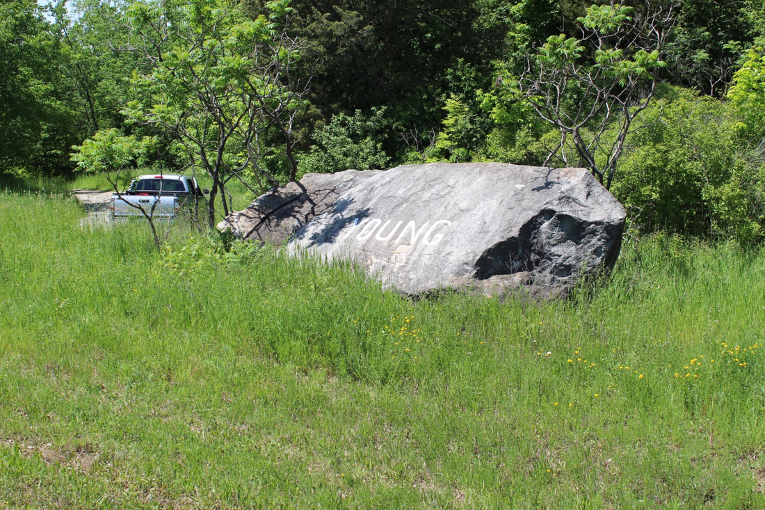
This is what the "YOUNG ROCK" looks like
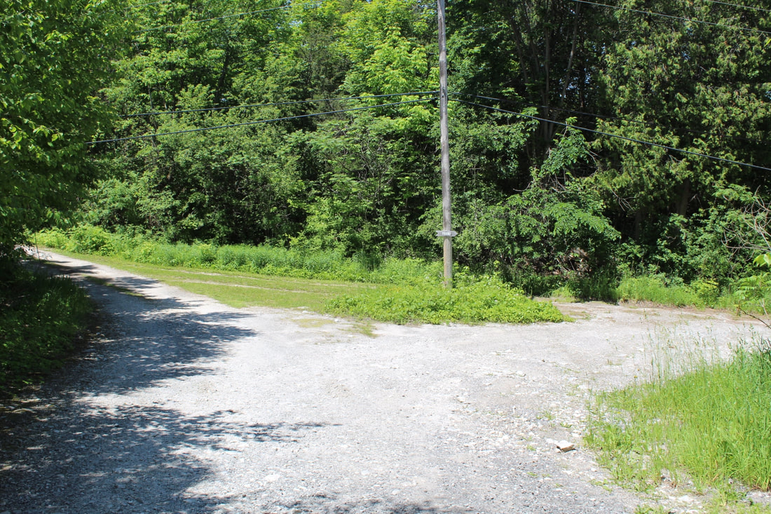
Take the LEFT fork after the YOUNG rock.

This is the other entrance, past the YOUNG rock. If you have a boat or other tow, this is the recommended entrance. Look for the blue sign for the bait shop.
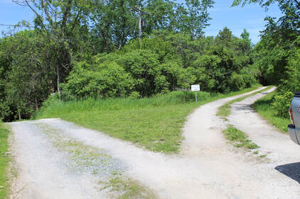
Take the RIGHT fork after blue sign for the bait shop.
|